Jersey Geology Trail |
|
Geophysical Surveys. |
|
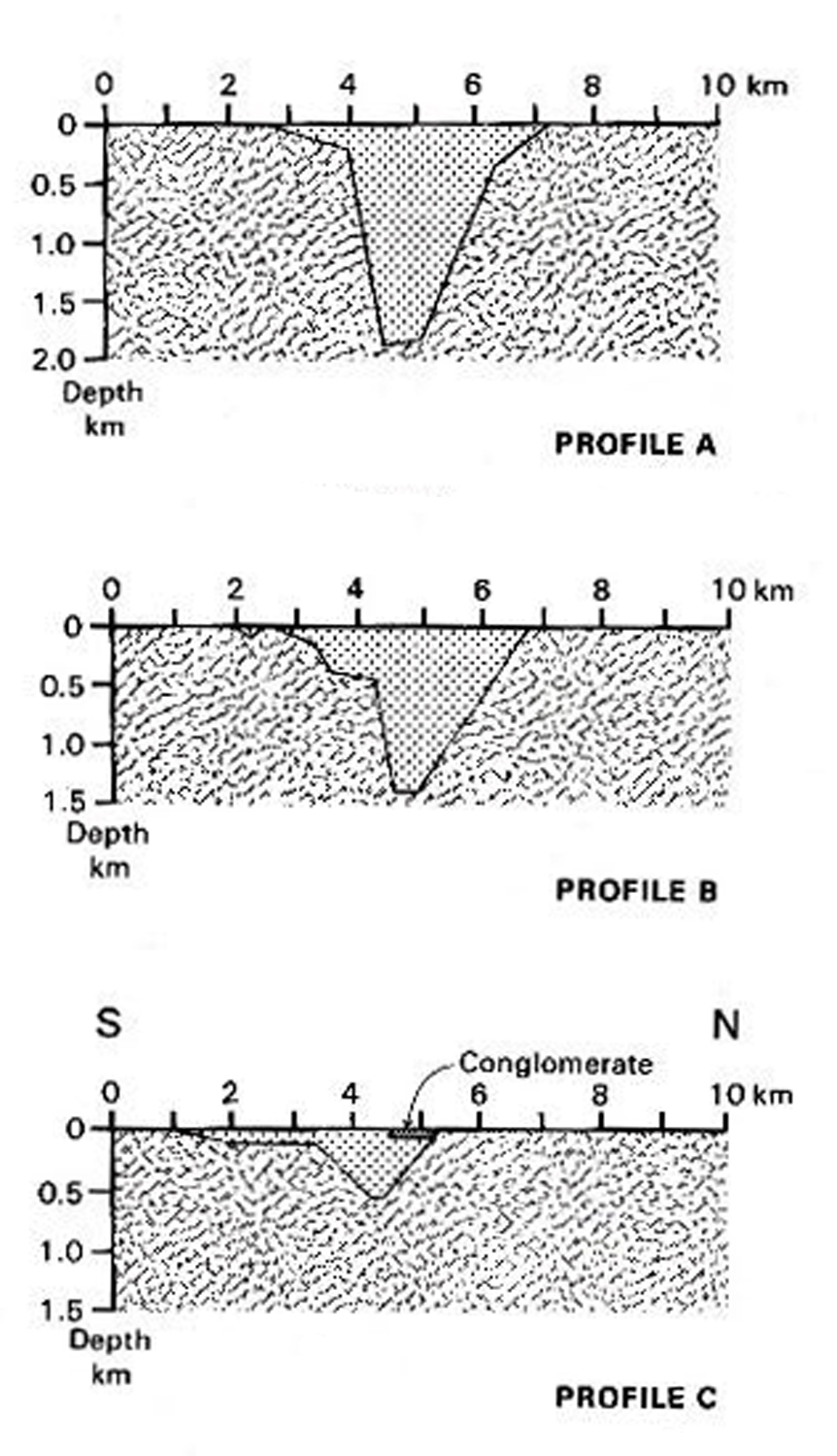
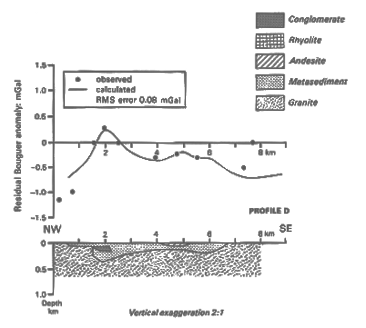
There are several different types of geophysical survey used to determine underground structures and rock types; the following have been used in Jersey. Other types of survey used in geological and archaeological exploration are; In Jersey, results of the Gravity Survey by Briden & Clark, 1989, p. 95 - 103) along the south and north coasts are discussed in detail (BGS. 1989, p. 95 - 103). Profiles A - C were drawn N - S (Fig. 1) eastwards from St. Ouën's Bay - Noirmont), across the Jersey Shale Formation deposits which indicate the 'Brioverian rocks form a raft c. 250m thick overlying rocks of granite density' (op. cit. p. 101). Profiles D, E were also drawn from NW - SE & SW - NE respectively (Fig. 1) across the central part of the island. From these, it was concluded that a 'positive anomaly does not match the surface geology in detail' (1989, op. cit. p. 96 - 7), but the anomaly is above various diorites in the SE granite even south of the coast and seems to be caused by a major diorite or gabbro body at depth. The results in the north east, around Rozel, result in 'improbable thicknesses' of the Rozel Conglomerate (loc. cit. p. 97) and may be a result of an 'offshore basic intrusion or a thickening of the Jersey Shale and Volcanic Group'. The residual anomalies which do not relate to 'known geology' have a short wavelength and are thought to reflect the topography of the granite Brioverian surface. In Jersey, a Magnetic survey of the eastern third of the island was done by Leeds University workers (Duff, 1989, p. 103) and a Gravity survey was performed by Briden et al (1989, p.95 - 102) (Fig. 2). A large Magnetic anomaly, noticed by Briden (BGS, Fig. 26. & p. 103 - 4), was found trending N - S. Its western edge coincided with the western edge of the St. Saviour's Andesite but a more distant eastern edge suggested the Andesite extended eastwards under the overlying Rhyolite sequence. Other features occurred along the northern edge of the SE granite and smaller ones within seemed coincident with the diorite (loc. cit.). Questions. |
|
 |
|
 |
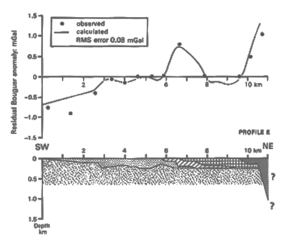 |
Fig. 1. |
|
 |
|
Fig. 2. Total field magnetic anomaly map of eastern Jersey (BGS op. cit.). | |
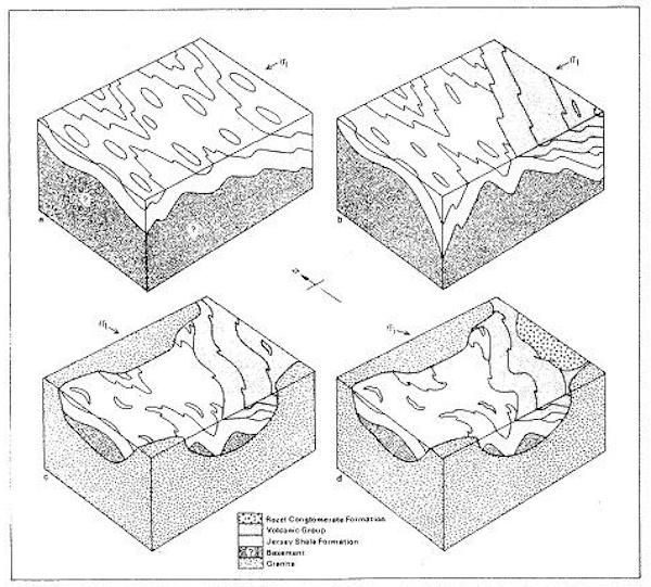
The following simplified block diagrams (a - d) show the stress field, rock units and major structures at various periods of the tectonic evolution of Jersey; D1, late D1, D2, D4. (Helm, D.G. 1984. PGA Vol. 95, p. 1 - 15). Compare the relative thicknesses (qualitative) with those from the geophysical surveys. |
|
 |
|
References. Bishop, A. C. & Bisson, G. 1989. Classical areas of British Geology: Jersey: description of 1:25,000 Channel Islands Sheet 2. pp. 95 - 103. (London HMSO for British Geological Survey) with references to Briden, Duff, 1989. |
|